Port Columbus International Airport (CMH)
Orientation and Maps
(Columbus, Ohio (OH), USA)
The capital city of Ohio, Columbus is a pleasant and clean city, offering plenty to see and do. Columbus is home to the prestigious Ohio State University (OSU), which is a major part of city life, with approximately 60,000 students in total.
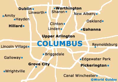
The Port Columbus International Airport (CMH) is located in the northeastern suburbs, close to Gahanna. The airport is easy to reach, being sited off the I-270 and I-670 interstates and connected by Capital City Flyer shuttles. Those looking to travel outside of the city will find a comprehensive network of buses, provided by Greyhound, with popular destinations including Cleveland and Cincinnati.
Port Columbus Airport (CMH) Maps: Important City Districts
Local buses around the city are run by the central Ohio Transit Authority and the station can be found along East Town Street. Tickets are reasonably priced and day passes offer excellent value for money. Maps of the main pickup points are available at the office along Broad Street. Further maps, transportation and tourist information in Columbus is available at the visitors center along South 3rd Street, in the City Center Mall.
One of the highlights in the city of Columbus is without doubt the German Village area, which lies on the southern side of the downtown district. With many well-preserved 19th-century brick buildings and cobblestone streets, the German Village is perhaps best known for its superb selection of top restaurants. Further eateries can be found on the northern side of downtown Columbus, in the Short North area, along the High Street. Here you will also find a number of jazz bars and stylish modern art galleries.
USA Map

Ohio Map

Columbus Map